Day 3 - Mevagissey - Polruan
Author: Jason
Statistics:
|
After the storm

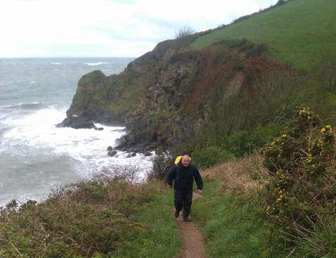
Tough going at Black Head
We'd managed to survive the storm! The weather was still a bit rough as we left our B&B, but was a vast improvement on the previous day. The rain had virtually stopped, but there was still an icy cold wind blowing in from the sea. It was going to be another day of waterproofs and damp boots – mine had failed to dry despite being stuffed with newspaper and spending the night next to a radiator. To cheer us up though we did get a small treat early in the day when a lady jogger in a tight Lycra top ran past us. This also gave us a visual confirmation of the low air temperature. Chapel coat-pegs and organ stops sprang to mind!
The first part of the walk was pretty hard going as we headed out towards Black Head. The paths were extremely muddy and the surrounding undergrowth – or more accurately overgrowth - was saturated. This led to a complete “wet out” of our boots and trousers. There were also several instances of what Dave terms “gentle undulations”. I personally prefer the term “bloody steep climbs”. Eventually though after a few hours of plodding we reached the historic harbour at Charlestown.
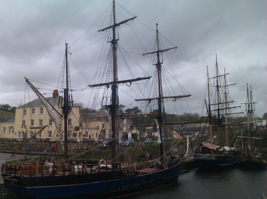
Charlestown has a very old fashioned and unspoilt feel, which has led to it being used as a film location on a number of occasions. Most notably it stood in for the Channel Island of Aldeney in the Michael Caine WW2 classic The Eagle Has Landed. I'd watched the film a few weeks before the walk and was able to point out some of the key locations to Dave. We even walked past the pub window that Donald Sutherland's character is thrown out of during the film! If you are reading this and are thinking “yeah, so what” you are not alone. Dave had a similar reaction when I pointed out this piece of cinematic history to him. “Film Tour” over, we pushed on, as the weather had again taken a turn for the worse. It was almost as if the retreating storm had decided to have one final fling before leaving us alone.

Charlestown
The next section of the walk around St Austell Bay was pretty bland by SWCP standards, being mostly through urban areas. At one point we even had a stretch of path for a mile or so that had a six foot garden fence either side of it. Needless to say the view was not great. Not even a lady jogger to improve things. Just before reaching Par Sands the path turned inland to divert around a large clay processing factory – I told you this section wasn't very scenic – then headed along a busy road for a while. As we approached the town we started to look out for the cafe that we had planned to have lunch at. It was located at a large garden centre, and we found it easily enough. We also found that is was closed for the day! What is it with us and cafes?
Luckily we found a small shop where we were able to buy some sandwiches and drinks. We headed towards the beach and found a picnic bench to sit on while we ate our al fresco lunch. There was not much of a view as the sea was hidden by some large sea defenses, but at least it was a sheltered spot. After lunch the path turned right and we headed out on the Eastern edge of the bay towards Gribbin Head. A few miles along the headland we reached the small village of Polkerris and stopped for a well needed brew. Polkerris had obviously decided to break with West Country tradition and had permitted it's cafe to open on a day that we were visiting.
Shortly after leaving Polkerris Dave said he was going to take a shortcut – codeword for going for a pee – and agreed that he'd meet me at the top of the hill we were climbing. Unfortunately, en route to the rendezvous point I managed to take a wrong turn. I knew things weren't quite right when the path I was on started to head inland. Things looked decidedly worse when the path abruptly terminated at an unexpected road. I looked around but could see no sign of Dave. The road I'd joined headed in roughly the same direction as the coastal path towards Gribbin Head, so I decided to stick with it. The plan was to take the first right-hand track that I came to, which should take me back to the coastal path and Dave.

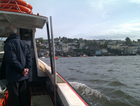
On the ferry from Fowey to Polruan
After about half a mile on the road I heard a voice in the far distance. I turned around and could see Dave running up the road behind me. He'd seen my “detour” from the top of the hill and had decided to give chase. Once he'd caught up with me and regained his breath he took the opportunity to comment upon my navigational skills. I seem to remember that his comments were generally positive and complementary, although they may have contained the words “f--king”, “useless” and “twat”.
Following the touching reunion we soon found a path that led us back to the coast, and were soon back on track heading towards Gribbin Head. Not too far now to Fowey, which was handy as we were in a race against time! In order to reach our B&B we needed to get a ferry from Fowey to Polruan, and the last one was at 17:00. If we missed the last ferry we'd be stuck, as the only alternative crossing of the river involved a 20 mile inland detour.
I'm tempted to add some false jeopardy at this point to make it sound like we only just made it to the last ferry in the nick of time. A desperate sprint through the streets of Fowey, followed by a death defying jump from a jetty onto the deck of the departing ferry! A scene reminiscent of Frodo and Sam in the Lord Of The Rings leaping onto the Bucklebury Ferry whilst being pursued by Ringwraiths. There was in fact no such drama, as we arrived in Fowey just before four o'clock. We also found out in the pub later that day that the ferry actually ran until ten in the evening!


