Day 2 - Pendeen - Porthcurno
Author: Jason
Statistics:
|
Turning the corner
Pendeen to Porthcurno is a fantastic stage, and I'd go as far to say that if you only ever do one part of the SWCP this is the bit to do. It has it all: breath taking cliff top paths, sweeping beach walks, descents into secluded coves, fantastic lunch stops, and of course national landmarks. It gives a real flavour of the whole SWCP, condensed into one day's walking. The only thing it doesn't have are the shaded wooded walks of North Devon, but these sections are very few and far between in Cornwall. In fact, in Cornwall trees are generally a bit of a rarity.
Given that I've just given this stage a massive “big up”, ironically it actually starts off on a rather downbeat note. That's because in order to rejoin the SWCP from Pendeen it's necessary to walk through a series disused mine workings. Although these have a lot of historical interest - the guided tours are great by the way – eye catching they ain't. In fact, the first few miles of the walk are more reminiscent of the surface of Mars than North Cornwall, comprising mainly of red muddy vegetation free scree.
Given that I've just given this stage a massive “big up”, ironically it actually starts off on a rather downbeat note. That's because in order to rejoin the SWCP from Pendeen it's necessary to walk through a series disused mine workings. Although these have a lot of historical interest - the guided tours are great by the way – eye catching they ain't. In fact, the first few miles of the walk are more reminiscent of the surface of Mars than North Cornwall, comprising mainly of red muddy vegetation free scree.
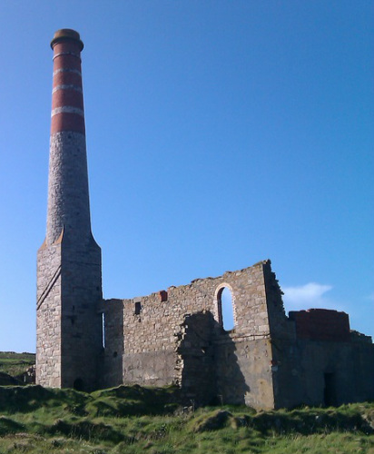
Disused mine workings near Pendeen
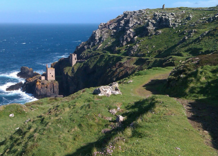
Things however pickup quickly, and very soon the path moves back towards the cliffs, revealing spectacular views back to Pendeen Watch Lighthouse. The disused mine workings also jump back a few centuries, as the grim corrugated dusty sheds of Pendeen are replaced with the traditional abandoned stone engine houses that the region is famous for. The workings at Levant are particularly impressive, perched precariously on the cliff like the remains an ancient castle.
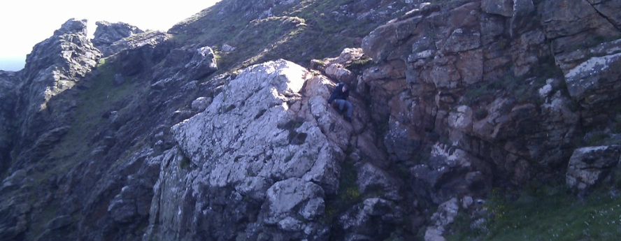
Once we passed Levant I think we took a wrong turn and ended up off of the main path. For once this actually turned out to be a good thing, as it added some excitement to the start of the day. The path – or goat track – that we ended up on started to wind downwards across the cliff, getting thinner and more indistinct as it went. Eventually, just at the point we were about to give up and retrace our steps we were confronted with a slab of rock, which dropped downwards almost vertically for about three metres or so. At the bottom of the slab the path could be seen continuing onwards, but they was no obvious easy way down to get to it. We therefore had our first section on the SWCP that required a bit of a scramble.
The “slab” actually wasn't too bad to get down in the end, as there were a number cracks in the rock that provided foot and hand holds. There was however a rather alarming drop-off on the seaward side, which provided a real incentive not to slip!
Once the “slab” had been negotiated the path went steeply upwards to a rocky windswept pinnacle, which again required a bit of scrambling to get to. After this the path then zigzag it's way easily back up the cliff, eventually rejoining the SWCP “main drag”. The next objective of the day was to reach Cape Cornwall. This was actually one place in Cornwall that both myself and Dave had never visited before, so something to look forward to. It didn't disappoint.
_Up until about 200
hundred years ago Cape Cornwall was considered to be the most
westerly point in England. That was until the Ordnance Survey came
along with their modern surveying trickery and whisked the title a
few miles down the coast to Lands End, much to the owners of Cape
Cornwall's disgust. Even back then there was money to be made in
tourism.
It's actually a shame that Cape Cornwall isn't the most westerly point in England, as it's a far more spectacular spot than Lands End. It comprises of a large rocky outcrop which forms a definitive most westerly point. At Lands End any number of rocky outcrops along about a mile of cliff could potentially be the most westerly bit. I'm sure they just picked the spot that it was easiest to build the gift shop on to be the “official point”. Cape Cornwall of course also has the distinct advantage over Lands End of being pretty desolate, and not infested with coach loads of tourists buying tourist tat and overpriced cups of tea. After Cape Cornwall the path ascended back up the cliff, then cut inland across moorland into a steep sided valley. We followed the valley down back towards the sea, alongside a pleasant rock strewn steam. Eventually we arrived at a small beach where some stone steps led up to a rocky outcrop. It was here that we met a bit of an oddball (must have been about the tenth one on this trip so far).
The chap actually seemed to be fairly ok initially. He had a couple of dogs - a Springer and lab - that we both made a fuss of, and he then started to tell us about some crossings to the Isles of Scilly that he'd recently made in a sail barge. He described the horrendous weather conditions on one such crossing, which made me feel seasick just hearing about it! The bloke then starting going on about the oncoming section of the path, and gave us some dire warnings about it being very tricky to negotiate, requiring what sounded like a death-defying scramble around a rocky outcrop. The way he made it sound we were about to traverse the north face of the Eiger, not a bit of coastal path. I must admit I was slightly nervous as we set off, dreading what was about to confront us.
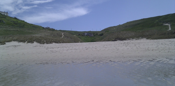
Sennon Cove
About 500 metres down the path we arrived at the “traverse from hell”. Well, it would have been if we'd actually had to climb down the cliff off the path to climb around the bit of rock the bloke had described. Fortunately, the footpath simply crossed above it with some very well made - and safe - steps. There was even a wooden handrail provided for extra “health and safety factor”. I've still got no idea what the bloke was going on about. It started to make me think that his tales of the high seas may have also been slightly exaggerated. The sea was probably like a millpond when he went across to Scilly, rather than being like the Cape of Good Hope on a bad day like he'd described it.
“Traverse” negotiated we carried on westwards, slowly descending towards the sea on a gently undulating path. Progress was only halted by a brief stop to put on water-proofs when grim weather started to blow in from the west. This was followed by an even briefer stop five minutes later to remove the water-proofs when the bad weather suddenly changed direction and blew harmlessly past us out to sea. We eventually descended onto the beach at Sennon Cove. It was then a case of finding the “Goldilocks Tidal Zone” – the area where the sand is at it's firmest, not being too wet or too dry. Once the G.T.Z had been attained we made good progress, and quickly arrived at Sennon Cove village for a nice lunch of Paninis and strong coffee at a beach side cafe. Dave “the Kid” ordered an ice cream just as we left to eat on the hoof.
From Sennon Cove it was a short walk back up the cliff, at which point the tourist honey pot of Lands End lurched into view. Or, as the residents of Cape Cornwall prefer to call it, T.S.M.W.P.I.E (the second most westerly point in England). Along the way we stopped to have a look at the rotting remains of the RMS Mulheim, a Romanian ship that ran aground in 2003. I'd read about it a few months earlier on a website devoted to derelict places. The site contained a series of “field reports” from people that had descended the cliff and entered the wreck to take photos. Quite interesting, although a risky pursuit. Dave referred to the site as “that subversive website you were looking at” when I mentioned it.
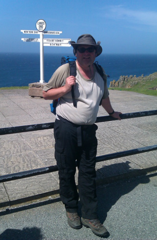
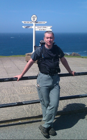
We didn't linger at Lands End, just stopping long enough for the obligatory photo at the famous sign. A pot of tea at five quid a throw was not enough to tempt us to stay. Fortunately, we hit the site outside peak tourist time, so it wasn't too hellish.
_After Lands End the
path became indistinct, splitting into numerous mini-paths. The
official SWCP acorn signposts also mysteriously vanished. This
situation was immediately blamed by Dave on the billionaire American
owner of the Lands End site. Within five minutes he'd had cooked up
an elaborate conspiracy theory involving the “Yank” removing SWCP
signs on purpose to drive walkers away from his precious tourist
trap. The theory also involved him generating sub frequency sound
waves, similar to those used by shop owners to deter groups of yoofs
from hanging around outside. And Dave calls me subversive!
Once we were out of “Dr Evil's Empire” normal service on signage was restored and we found the main path. A few miles on we passed The Armed Knight, a famous off-shore rock that's had an archway drilled into it by the sea over millennia. We also passed an odd clifftop rock formation that resembled a giant stone hedgehog. A treat for geologists and nature lovers alike. The path then turned from southwards to eastwards, as we turned the corner at the end of England and left the north coast of Cornwall behind. The remainder of the walk would now be towards the east.
The day was now getting on and my feet where starting to hurt, although no where near as much as on previous years. It was still a welcome relief to descend into Porthgwarra and find a refreshments hut with a pleasant garden to sit in. Even better, they had excellent home-made cake, which made a nice addition to the mugs of tea we ordered.
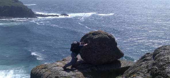
Dave attempts to push the "Stone Hedgehog" into the sea
_While we were
resting we had a chat with a chap that was starting his Lands End to
John O Groats walk. Such people are obliviously not uncommon in this
part of the world, but this chap (Pete) had the USP of doing the walk
with his Springer Spaniel Henry. The walk was in aid of the Hounds
For Heroes charity, which provides aid dogs to injured service
people. Pete was a journalist that had been involve with the military
during his working life, and now semi-retired had decided to take on
this challenge. Looking at his very weighty backpack containing a
tent, cooking gear, food, sleeping bag and of course dog food he certainly had a challenge on his hands.
Refreshed, it was then
a fairly short walk along the coast to Porthcurno,which we finally
reached by descending a steep stone staircase at the side of the
Minack theatre. It was then a short stroll up the high street to our
B&B.
That evening we popped down to the Cable Station Inn, which was the only pub in the village. I'm not sure if they also only had one gay. To be honest, when we arrived at the pub it was a bit dead, and it looked like an early night was on the cards. We ordered a couple of pints – Tribute I seem to remember – plus the local speciality which was “Cornish Spaghetti Bolognese”. Not a bad spag bol as it turned out, but I suspect that it would have kicked-off big time if an Italian had walked in, only to find that their national dish had been hijacked by the Cornish. I suppose they could have retaliated by inventing “Italian Pasties”.
That evening we popped down to the Cable Station Inn, which was the only pub in the village. I'm not sure if they also only had one gay. To be honest, when we arrived at the pub it was a bit dead, and it looked like an early night was on the cards. We ordered a couple of pints – Tribute I seem to remember – plus the local speciality which was “Cornish Spaghetti Bolognese”. Not a bad spag bol as it turned out, but I suspect that it would have kicked-off big time if an Italian had walked in, only to find that their national dish had been hijacked by the Cornish. I suppose they could have retaliated by inventing “Italian Pasties”.
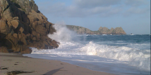
Swell at Porthcurno Beach/Campsite
After dinner we had a wander down to the beach to stretch our legs. It was a nice warm evening, but quite a swell had picked up out to sea, and there were some impressive breakers rolling in. While we were on the beach we noticed that a bloke had pitched a tent on the beach with his two kids. Eventually the bloke wandered over to us and asked if we were local, and if we knew how far the tide would come in. Dave explained that weren't local, but as high tide was still an hour away he'd advise moving the tent back up the beach a bit to be on the safe side. The bloke shrugged at this advice and said he was going off for a “smoke”. We got the impression that it wasn't tobacco that he had in mind.
We wandered back up the hill and decided to give the Cable Station Inn another chance. It had picked up since we'd left earlier, with a few locals now in the bar. There were also two blokes – a father a son – doing a bike ride from, you've guessed it, Lands End to John o Groats.
After a couple of beers the door of the bar suddenly flew open and in walk the bloke from the beach and his kids. The fella and his daughter were soaked and covered with sand and seaweed, but the young lad was bone dry. Apparently a rogue wave had come in just as the tide was turning and wiped out the tent while the fella and daughter were in it! The boy had escaped because he was outside playing. The tent and most of their stuff was now halfway to the Isles of Scilly. The bloke ordered a taxi to take them all back to Penzance, while the locals laughed it all up. We also found it amusing, especially after the bloke had ignored Dave's advice. That said, we did feel sorry for the girl who was frozen and clearly shaken by the experience. Responsibly parenting and all that.

